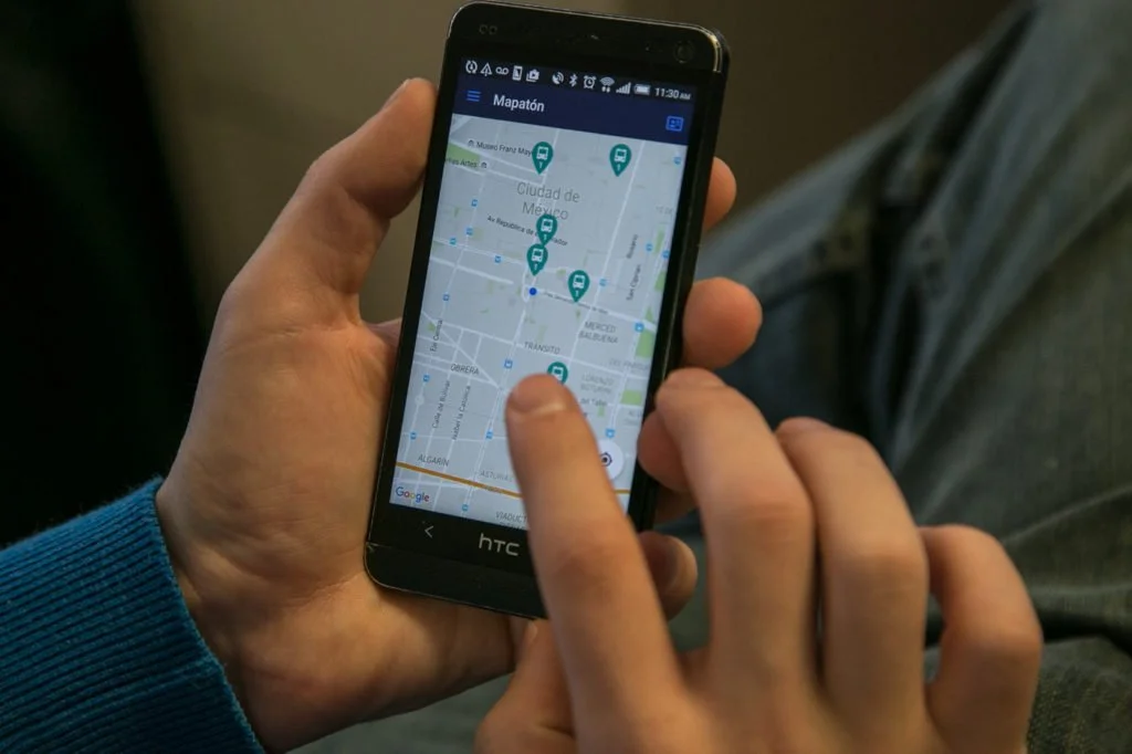
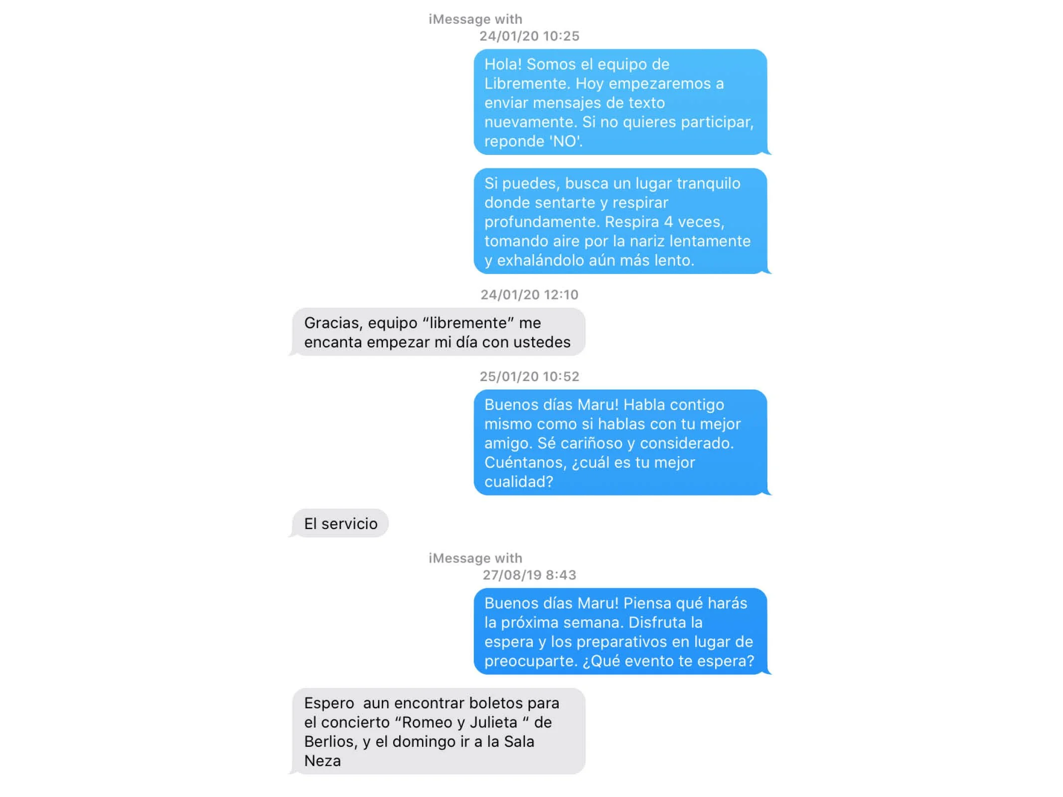
Four Freedom Speech Park was named after Roosevelt’s famous speech about universal freedom.
Freedom of speech, Freedom of worship, Freedom to want, Freedom from fear
Thirteen months after delivering his freedom speech, Roosevelt forced Japanese Americans into relocation centers. He ordered Mexico to relocate and surveil Japanese as well.
As part of Roosevelt’s anti-Japanese policy, my great uncle, Masao Limuro spent 7 years in a prison island without trial. Roosevelt Island housed prisons as well.
I didn’t want to make an unhopeful piece about a past that can’t be changed, but did want to acknowledge the obscured stories of interim camps while recognizing the ongoing pursuits for freedom.
I invited ~80 participants to hang Japanese wind-chimes and write how do they advance freedom today. The collective sound of wind chimes became the soundtrack for a spoken word performance about our non-linear pursue for freedom.
In my windchime, I hid one of the intercepted letters used to imprision my uncle.
Because during the COVID-19 pandemic, we know social distancing saves lives.
@6ftlove is an artistic Instagram solidarity movement for social distancing as we work to collectively #flattenthecurve during the COVID-19 Pandemic. We want to spread the message that just because we are practicing social distance doesn’t mean we can’t be social or connect with people - whether it be loved ones or strangers on the street. Solidarity and collective action are the keys to defeating COVID-19. Let’s spread the #6ftlove.
The purpose of this campaign is not to share specific guidelines (we will leave that to the experts), but the rather to mainstream the need for collective action and remove the barriers (psychological or otherwise) to social distancing.
We are at a turning point in the battle against coronavirus. It is more important than ever to build a collective movement for social distancing. We must act now to share accurate and consistent messaging around social distancing. While the exact restrictions and guidelines around social distancing vary from one place to another, for a global problem like this, we need a universal approach.
We are concerned that many people, young and old, have so far been complacent about the threat posed by COVID-19. Evidence-based action can help contain the spread of this unprecedented pandemic.
Press: The Hindu, Hindustan Times
Libremente is an SMS-based program that aims to address the challenges of post-disaster mental health. The program is designed specifically for populations in the early recovery stage of disaster relief.
Libremente’s program leverages behavioral activation, a psychological treatment proven to address post-traumatic stress disorder (PTSD), and an SMS-based program to facilitate mental health recovery. Participants receive text messages that invite them to perform short activities that encourage personal reflection and community interaction.
Integrated impact evaluation
The first pilot was developed in Lima, Peru 2017 in collaboration with suburban communities affected by floods. Over the course of a one-week pilot, we saw a near 100 percent participation rate, and a 68 percent response rate in a group of over 30 participating mothers. This group included mothers sharing phones — and therefore only one phone number could reply — and at least one mother who was illiterate. These results underscore the importance and scalability of a wide-reaching media intervention in the post-disaster recovery space, particularly in regards to underserved communities in need of mental health resources.
In 2018, we worked with health providers in Puerto Rico to develop a second pilot for five local communities impacted by Hurricane María. After a six-week program, participants improved their perceived sense of support and learned about other resources in their community. A pre-post survey showed reduced levels of stress and anxiety.
My Role: Co-Founder & Design Principal
Team: Aashka Dave, Kari Strømhaug, La Victoria Lab, Koru, PUC, Clinica de Salud de COSSAO.
Client: Survivors of floods in Peru, and hurricane in Puerto Rico
Location: Lima, Peru (2017) - Utuado, Puerto Rico (2018)
Status: Developing a third pilot in Grand Bahama, Bahamas.
Awards: MIT Ideas Competition 2018
Platform and Strategy for Peer-to-Peer Aid Coordination
Manos a la Obra is a digital tool and a crowdsourced effort aimed to address the civic emergency caused by the severe earthquakes that impacted Mexico in September 2017. The objective of this tool is to first collect and then help connect offerings and requests for aid. In order to operate, Manos a la Obra integrated three components:
A website where people with filters by need and location.
An open database connected with two call-centers in Mexico City, a civic effort for verifying data called Verificado19s, and private consultants working for the federal government like Mckinsey.
Geotargeted Facebook advertisements to reach users that are far out from preexistent social networks.
Manos a la Obra was deployed two hours after a 7.1 earthquake shocked central Mexico. Both the tool and the team evolved quickly with an open-source and open-data philosophy. The strategy had a flexible design that stayed effective throughout the changing needs of the disaster; rapidly moving form requests on shovels and flashlights to food and water needs.
Social Media for Social Good
Manosalaobra’s Facebook group reached 7,279 followers. Posts had an average reach of 149,468 people, with a maximum of 512,053 and a minimum of 624 people reached. An open code on GitHub allowed collaboration from developers in both Mexico and the US. And future development of a similar tool for COVID-19 called frenalacurva.org In addition, the geospatial analysis showed that calls for help were coming from affected areas. Calls for help outside declared emergency areas were verified as legitimate by a local allied.
My Role: Founder & Partnerships Manager.
Core Team: Sergio Cantú, Adriana Crespo, Akemi Sato, Daniel Palencia.
Client: Earthquake survivors.
Location: Mexico - Boston (2017).
Status: 8 weeks of service, collecting 1,813 entries.
News: MIT News, TEC Review, CNN Latinoamerica.
Community-Based Strategy for Public Spaces
Barrilaco Ravine is a 30-hectares conservancy area governed by eight different authorities, ranging from the neighbors’ committee to local and federal organizations. Disagreement between the organizations left Barrilaco abandoned and by the year 2000. The crime rate became such that night-use was forbidden and day-use recommended for men and dog owners only. A Master Plan developed between neighbors and a|911 helped to align all the authorities and their budgets to collaborate in Barrilaco’s restoration. An implementation plan, designed by Sustrato, helped neighbors become active users and to advocate for the project. This process has allowed the community to collect over 640,000USD and to implement the project despite local disagreements and political changes. Through implementation, neighbors and authorities have created a constructive civic dynamic.
Multiple stakeholders bring multiple resources
The diversity of people and agencies involved in Barrilaco is now an asset. There is a growing list that stared with the following agencies: Ministry of Water (CONAGUA), Ministry of Environment (SEMARNAT and SEDEMA), Ministry of Housing (SEDUVI), Water System of Mexico City Government (CONAGUA), Public Projects of Mexico City Government, Community Participation Miguel Hidalgo, Urban Services of Miguel Hidalgo District, three different neighbor’s committees, Proyecto Vecinal Barranca de Barrilaco.
My Role: Project Manager at Sustrato, and a|911
Team: Sustrato, a|911, Alvarez, M., Laviada, B.
Client: Neighbors of Lomas de Chapultepec
Location: Mexico City (2011-2017)
Status: Built, continuous neighbours-led improvement
Collaborative Design for Neighborhood Improvement
El Peral Park occupies 150sqm of a former wasteland. The park is adjacent to an underserved neigborhood, Rinconada Santa María, where loitering and alcoholism are rampant. The neighborhood conditions allowed access to federal funds earmarked for marginal areas. The money was designated for placing a couple of steel umbrellas and a “green wall” in a vacant lot. However, this proposal didn’t fit people’s expectations. How could we build a space that excites locals but fits the government’s limitations? With a better-fitted program, 30,000 USD, and an unemployed population. The neighbors, a constructor, and I developed a project where the components were delegated. Some members of the community took on demolition and some construction themselves, some others completed finishings. After six months of collaborative work, the neighbors got to know each other and now take care of the space. To the date, they use this space for holding peer-to-peer workshops for learning how to cook, dance, build bicycles, and how to grow plants.
Buildings are flexible structures.
Neighbors took ownership of their space and keep reinventing it to fit their changing needs. They have used the structure for air-dance performances and inaugurated an art gallery on the fence. A local committee coordinates programming and activities between neighbors who were strangers before this project started.
My Role: Co-Founder & Co-Director at Sustrato.
Team: Sustrato, TAT Constructora, Comité Vecinal.
Client: Neighbors of Rinconada Santa María, Mexico City
Location: Rinconada Santa María, Mexico City (2016)
Status: Built
Strategy to Map Mexico City’s Transit Routes
MapatonCDMX is a gaming app designed to crowdsource the public transit routes of Mexico City. Before MapatonCDMX, the city lacked information on the informal transit system that accommodates 60 percent of the city’s commutes. In addition, the city lacked the resources for hiring a traditional mapping consultant. Instead gathered a team of creative consultants of which I was part.
The team developed a cell-phone game that helped citizens map their routes while rewarding them with virtual prizes. The algorithm for prices was designed to motivate the mapping of the most obscured routes and to identify potential cheaters.
Crowd-sourcing in a Crowded City
The MapatonCDMX app was first used in February 2016 to hold a civic competition to map Mexico’s urban transport. In two weeks the 3,557 MapatonCDMX users mapped 51,308 km (31,881 mi). Users spent a total of 685,188 minutes (equivalent to 475 days) actively mapping. The data collected is now openly available as a GTFS.
My Role: Mobility Consultant.
Team: LabCDMX, CETRAM, SEMOVI, PIDES Innovación Social, Krieger Electronics, ITDP Mexico, Planeación & Desarrollo SC, M+urbano, Transconsult, Ally, and Urban LaunchPad. Supported by the Hewlett Foundation and the British Embassy in Mexico.
Client: Ministry of Mobility (SEMOVI).
Location: Mexico City (2015-2016).
Status: Open GTFS with validated data.
Awards: Guangzhou Award for Urban Innovation, China 2017.
Papers: OECD Case Studies, IGLUS, Beyond Bureaucracy, Legible Policy
Nano-concrete Street Furniture
M+urbano is an industrial design firm that designs, manufactures, and produces street furniture based on nano-concrete. m+urbano has designed a manufacturing process that trains and employs local labor and utilizes nanometric by-products of local industry (turning fly-ash from a pollutant into a material). In addition, our concrete mix reduces CO2 emissions by 80% because the mix requires only one fifth of cement.
m+urbano products ranges from a 30x30cm wall planter to a 50sqm bench installation. Our designs can be found in public spaces such as the Malinalco’s central square in Estado de México (64 benches) and Tamayo Museum in Mexico City; can also be found in design venues such as Blend Store and Design Week Mexico.
m+urbano products require low maintenance because nano-metric porosity reduces permeability and corrosion, and qualify for LEED points for Material and Resources (MR) and Design Innovation (ID).
My Role: Co-founder and Partner with Alejandro Carvajal
Location: México (2013-2016)
Status: Three years of operation before merging with MDC
Awards: Diseño Inédito, Mexico Design Week 2015
Team: Andrés Abella, Jerónimo Aguilar, Alejandro Carvajal, Jose Luis Delgado
Press: Podio 2015
Ravine Protection Policies for Fire-Risk Reduction
Every summer, elevated temperatures, high winds, and dry weather mix in the ravines of Valparaiso. This combination tends to originate destructive wildfires. In addition, due to the lack of available land, informal settlements develop around high-risk areas polluting the ravines and paving water streams.
Policy changes to historic preservation will allow higher density in safe areas and recognize the ravine ecosystem as a natural heritage that also requires preservation. Current urban dynamics understand that neighborhoods are organized by watershed. The new master plan will recognize watersheds’ social organization to foster environmental accountability by ravine and will integrate the natural topography by promoting new zoning that develops perpendicular to the sea, to integrate the organization by watershed.
Zoning most dialogue with urban dynamics
Mapping workshops with community members revealed that former city plans where ignoring the city’s dynamics. As a consequence, inhabitants were unable to adhere to such plans. The new Master Plan aims to integrate ongoing dynamics and a shared vision of the city.
My Role: Urban Planner & Designer
Team: PLACECO, Plancerro.
Client: Municipality of Valparaíso
Location: Valparaiso, Chile (2017)
Status: Approved by the Municipal Council and the Ministry of Housing
More Effective Public Transit for Connecting Downtown Mexico
Nevertheless, this project had to prove its advantages as a counter-proposal to a tourist tram. In-depth analysis proved that buses were a more feasible option –covering a larger and more demanded route, being flexible in the face of street closures and public services vehicles, reducing a comparable amount of carbon emissions, and integrating with the city mobility network.
The proposal was challenged by narrow streets with intense pedestrian activity and entrenched neighbors and business owners –who now value the benefits of sidewalk design and urban connectivity. In addition, money savings allow extending the BRT line to the International Airport.
My Role: Lead Designer and Project Manager at a|911
Client: Ministry of Transportation
Location: Mexico City, México (2010-2012)
Status: Built with an extension to the airport
International Exhibition on Future of Urban Mobility
In the future, urban mobility will prioritize people over vehicles. Urban life in Tacubaya will stop happening in the left-overs of urbanization but at the center of urban design. By 2030, Tacubaya will be connected to the rest of the city, and mobility policies will encourage high-density and mixed-use development. In addition, pedestrian overpasses and tunnels will be extinct so pedestrian crossing will happen at ground level. The proposal develops three concepts:
Tacubaya multimodal transport center, a public building that concentrates and organizes public transit while opening upper levels for retail and culture.
Civic plaza and people-friendly streets, the design prioritizes pedestrian activities such as walking, visiting the public market, or Tacubaya’s central square.
Infill development projects, improvement of public infrastructure, and policies for efficient use of unoccupied land and parking lots.
My role: Project Manager & Urban Designer at a|911
Team: a|911, Ana Álvarez.
Client: Institute for Transportation and Development Policy (ITDP)
Location: Tacubaya, Mexico City, México (2011)
Status: Project for International Exhibition
Landscape Design to Reduce Crime and Flood-Risk
The Master Plan is one of the 150 commitments included in “We all are Juárez” crime-reduction strategy led by the federal government in Ciudad Juarez. At that moment, Juarez was the deadliest city on Earth.
Ciudad Juarez is a desert city located on the US-Mexico border. In this strategic position, both legal and illegal industries benefit from international trading and cheap labor. Since the end of the Bracero Program in 1964, migrant workers have been developing informal housing in flood-risk areas, located far from urban utilities, transit, education, and health facilities. Continuous floods resulted in vacant lots where organized crime cuartels.
Research revealed the potential of repurposing vacant spaces for multiple uses: stormwater management, capacity building activities in the short run, and economic opportunities in the long run. A green corridor with commercial activity will run in-between two abandoned water retention basins that will be consolidated as seasonal public spaces –playgrounds, sports facilities, a skate park and horticulture terraces will be available at different levels of flood– a community workshop and progressive housing will be built on a flood-safe perimeter.
My Role: Project Manager & Urban Designer at a|911.
Team: a|911
Client: Ministry for Social Development (SEDESOL)
Location: Ciudad Juárez, México (2011)
Status: Project
Awards: Bronze Holcim Awards Latin America 2011.